Download Latest SODmap kmz File
Note: If the SODMAP data do not load automatically, open the kmz (Google Earth) file from the downloads folder in your browser. The SODMAP kmz file, by default, opens in the “Temporary Places” folder in Google Earth with only the last year’s data visible. To view all years’ data, click twice on the box next to SODMap 2023 kmz folder. To select or exclude datasets from individual years, click on the selection arrows pointing at SODMap Positives for positive samples and SODMap Negatives for negative samples. Displaying multiple year’s data may cause some computers to run more slowly.
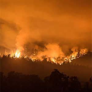
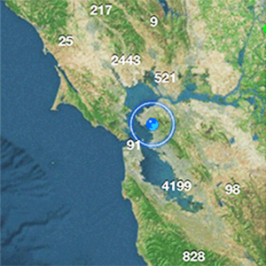
The SODMAP Project is a partnership of scientists and citizens, working together to create the most complete distribution map of a forest disease ever produced in North America. SODMAP incorporates laboratory confirmed collections of plant and water samples from 2005 to the present. It includes both SOD-positive, as well as, SOD-negative specimens to better illustrate the range and distribution of the disease.
SODMAP is the result of a collaboration between hundreds of citizen scientists participating each year in the SOD Blitzes organized by the U.C. Berkeley Forest Pathology and Mycology Laboratory, other research organizations, and government facilities. Contributors to the SODMAP include: M. Garbelotto, UC Berkeley; D.M. Rizzo, U.C. Davis; Ross Meetenmeyer; UNC Charlotte, Ted Swiecki, Phytosphere Research; Don Owen, Cal Fire; Jack Marshall, Cal Fire; Cheryl Blomquist, CDFA; Lisa Bell, UCCE; Yana Valachovic. UCCE.
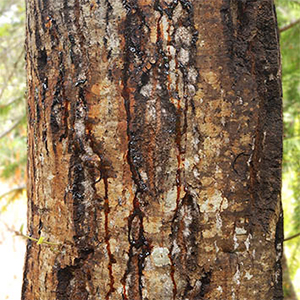
Based on our current knowledge, only oaks within 1 km (0.6 mi) of known infected trees are at high risk of becoming infected. Water results are indicative of presence of the SOD pathogen in a water course, but should not be used to determine risk of infection for neighboring trees. We urge all oak owners to check the SODMAP yearly and to take preventive action to protect their trees if infections are reported within 1 km of their property. Detailed management recommendations can be learned by attending free SOD workshops or community meetings organized around the Bay Area.
Don’t have Google Earth? Download it for Free
This project made possible thanks to funding from:
USDA Forest Service, State and Private Forestry
PG&E Foundation